Top Five Moab Off-Road Trails Ranked by Difficulty
Share
White Rabbit Offroad lives for red-rock carnage and slickrock sunsets—we’ve wheeled a lot of miles in Moab, snapped axles, blown brakes and replaced more parts than our paychecks could handle, but in the end, we still smiled. Below are the five best off-roading trails in Moab ranked from brutal to beginner-friendly, complete with waypoints, drive time from downtown, must-see stops, and hard-earned tips that keep you safe and stoked.
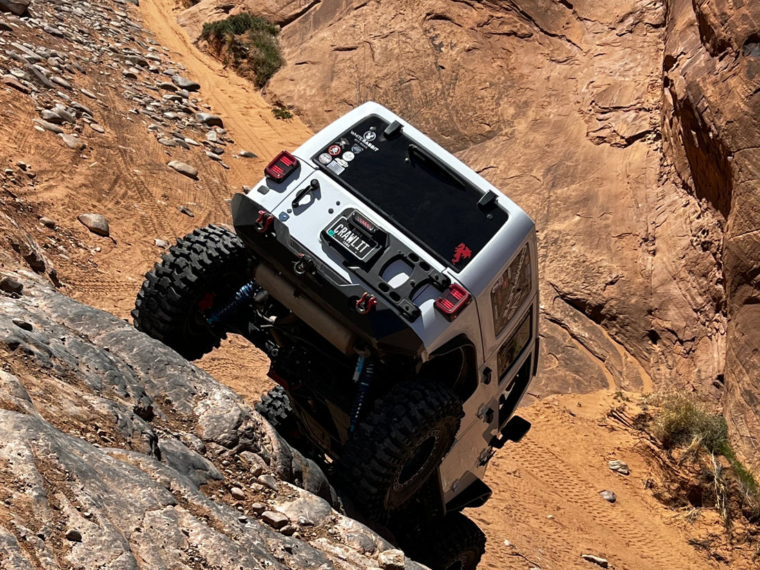
Pritchett Canyon — The King of Carnage
Moab’s Hardest 4×4 Trail (Difficulty 9–10)
Fast facts
- Trailhead GPS: 38.5381° N, 109.6104° W
- Distance from Moab: 8 mi (≈ 20 min) via Kane Creek Blvd
- Mileage: 4.4 mi one-way (8–10 mi if you exit via Behind-the-Rocks)
- Famous obstacles: Chewy Hill, Rocker Knocker, Axle Hill, Rock Pile, Yellow Hill
- Permit: $10 per rig (private easement—pay at gate)
Why it tops the list
Five gnarly obstacles in the first two miles, zero bypasses, and ledges tall enough to swallow 40s. You’ll need lockers front and rear, 37-inch tires (minimum), a 10k-lb winch, and a spotter who doesn’t panic when sheet-metal screams.
Pro tips
- Carry a 100-ft winch extension—Chewy Hill loves to yank cables short.
- Budget 6–8 hours if you exit through Behind-the-Rocks; turning around is often slower than pushing forward.
- Summer temps soar above 100 °F. Bring 1 gal of water per person, per 3 hrs.
Hell’s Revenge — Slickrock With Serious Consequences
Legendary 4×4 Playground (Difficulty 6–7)
Trail cheat sheet
- Trailhead GPS: 38.5955° N, 109.5188° W (Sand Flats staging lot)
- Distance from Moab: 2 mi (≈ 10 min)
- Mileage: 6.5-mi loop
- Signature obstacles: Hell’s Gate, Escalator, Tip-Over Challenge, the Hot Tubs
- Pass required: Sand Flats Recreation Area ($5 day / $20 week)
Why you’ll love it
Iconic petrified sand dunes—“fins”—offer roller-coaster climbs and off-camber drops with 360° views of the La Sal Mountains. Bypass lanes exist, so mixed-skill groups can ride together.
Need-before-you-go
- 33″+ tires and a rear locker recommended.
- Air down to 12–15 psi for sandstone traction.
- Follow the painted white dashes—straying off-trail trashes cryptobiotic soil and triggers big-time BLM fines.
Fins & Things — Moab’s Crowd-Pleaser
Moderate Slickrock Loop (Difficulty 4–5)
Quick numbers
- Trailhead GPS: Same staging lot as Hell’s Revenge
- Distance from Moab: 3 mi (≈ 12 min)
- Mileage: 14 mi figure-eight loop
- Highlights: Scorpion Hill, French Canyon overlook, Baby Lion’s Back
Why it ranks #3
Steep slickrock fins separated by sandy washes. Obstacles have optional bypasses, making this the best intermediate off-road trail in Moab for new Jeepers, full-body Broncos, and adventure UTVs.
Trail hacks
- Start clockwise at sunrise—the fins glow orange for unbeatable photos.
- Stock 4×4 with skid plates survives fine; manual transfer-case low range is a plus.
- Expect 3–4 hrs with photo stops.
Hurrah Pass to Chicken Corners — Big Views, Low Risk
Easy-Moderate Desert Shelf Road (Difficulty 3–4)
On your dashboard
- Hurrah Pass trailhead: 38.5446° N, 109.6225° W
- Distance from Moab: 12 mi (≈ 30 min) via Kane Creek Blvd
- Mileage: 20 mi out-and-back
- Must-see stops: Hurrah Pass summit, Colorado River panoramas, Catacomb Rock, sheer cliff at Chicken Corners
What makes it shine
Endless vistas without the adrenaline tax. The shelf road near Chicken Corners is narrow with 400-ft cliffs—enough puckering to feel adventurous but still doable in a high-clearance stock 4×4.
Pack list
- Extra drinking water—shade is rare.
- Camera drone (where legal) for over-river shots.
- Binoculars for bighorn sheep on the cliffs.
Shafer Trail & Potash Road — Canyonlands Gateway Cruise
The Scenic Beginner Drive (Difficulty 2)
Key stats
- Lower trailhead GPS: 38.5654° N, 109.6171° W (Potash Rd/UT-279)
- Distance from Moab: 5 mi (≈ 10 min) via UT-279 or 22 mi (≈ 45 min) via Canyonlands NP Island-in-the-Sky
- Mileage: 32 mi point-to-point (Potash to Shafer)
- Sights to bank: Potash petroglyphs, Thelma-&-Louise Point, Shafer switchbacks, Dead Horse Point spur
Why it rounds out the list
Graded dirt, epic canyon drop-offs, and film-worthy switchbacks—the perfect scenic 4×4 drive near Moab for families and photography junkies. A Subaru with good tires can finish if weather’s dry.
Before you go
- National-park entrance fee applies if starting from Island-in-the-Sky.
- Check weather—rain makes switchbacks slick.
- Expect 2–3 hrs with photo breaks.
Trail-Prep Checklist: Conquer Moab, Respect the Desert
Permits & Passes
- Sand Flats Rec Area (Hell’s, Fins).
- Canyonlands NP (Shafer from Island-in-the-Sky).
- Private easements (Pritchett).
Recovery Gear
- 10k-lb+ winch, kinetic rope, soft shackles.
- Tire repair kit + onboard air.
Navigation
- Download offline GPX files in Gaia GPS or OnX (keyword: “Moab master map GPX”).
- Carry printed maps; cell signal vanishes fast.
Tread Lightly Rules
- Stay on marked routes—crypto soil = fragile crust that takes centuries to heal.
- Pack out every scrap of trash.
Seasonal Reality
- Spring snowmelt = flash-flooded washes.
- July–August temps slap 110 °F—wheel at dawn.
- Winter ice hides on north-facing slickrock; bring chains if snow’s forecast.
Final Thoughts
Whether you crave the bragging rights that come with conquering Pritchett Canyon, the hardest off-road trail in Moab, or you just want the jaw-dropping canyon vistas on Shafer Trail without body damage, Moab delivers. Respect the land, build your rig for the rating above, and—like we always say at White Rabbit Offroad—Follow the Trail. Burn the Map.
Ready to rep the lifestyle? Check out our ultra-soft, dirt-approved gear at WhiteRabbitOffroad.com.